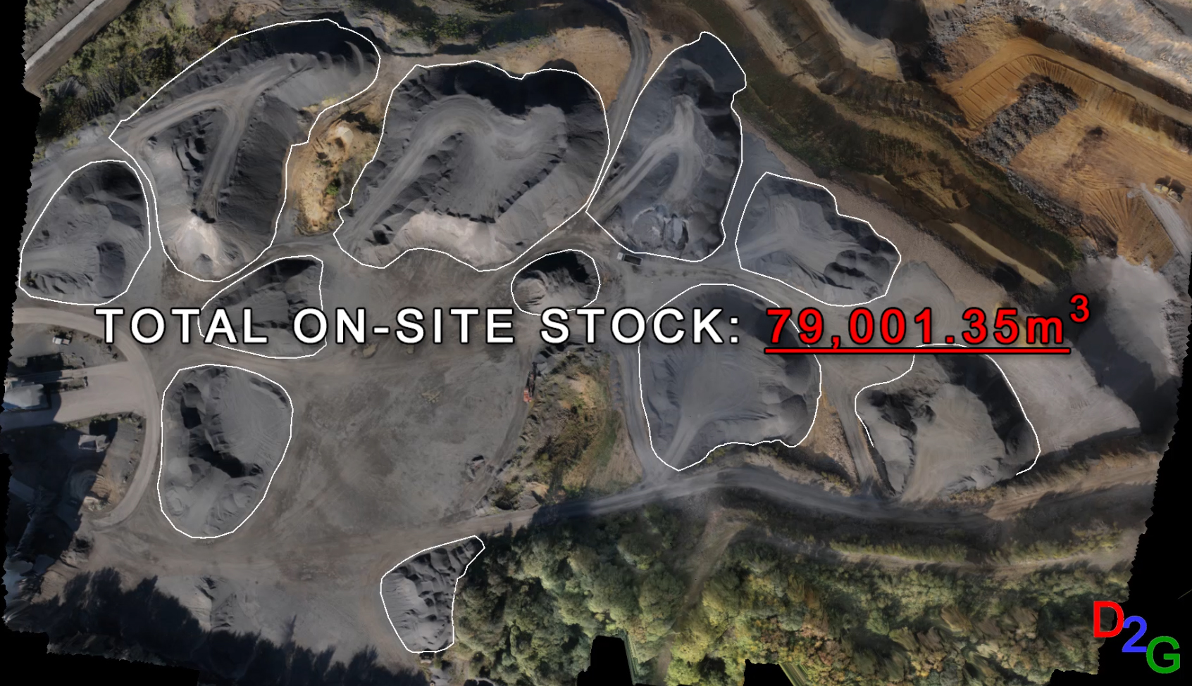
Drone2GIS offers a safe, efficient and accurate alternative approach to the conventional surveying method employed in open cast mines, quarries and stock yards for data acquisition. Through the employment of Unmanned Aerial Systems, Drone2GIS delivers precise, high accuracy ortho-photos, digital terrain models and virtual realities. With these products, we can extract features and positions to […]
Continue reading