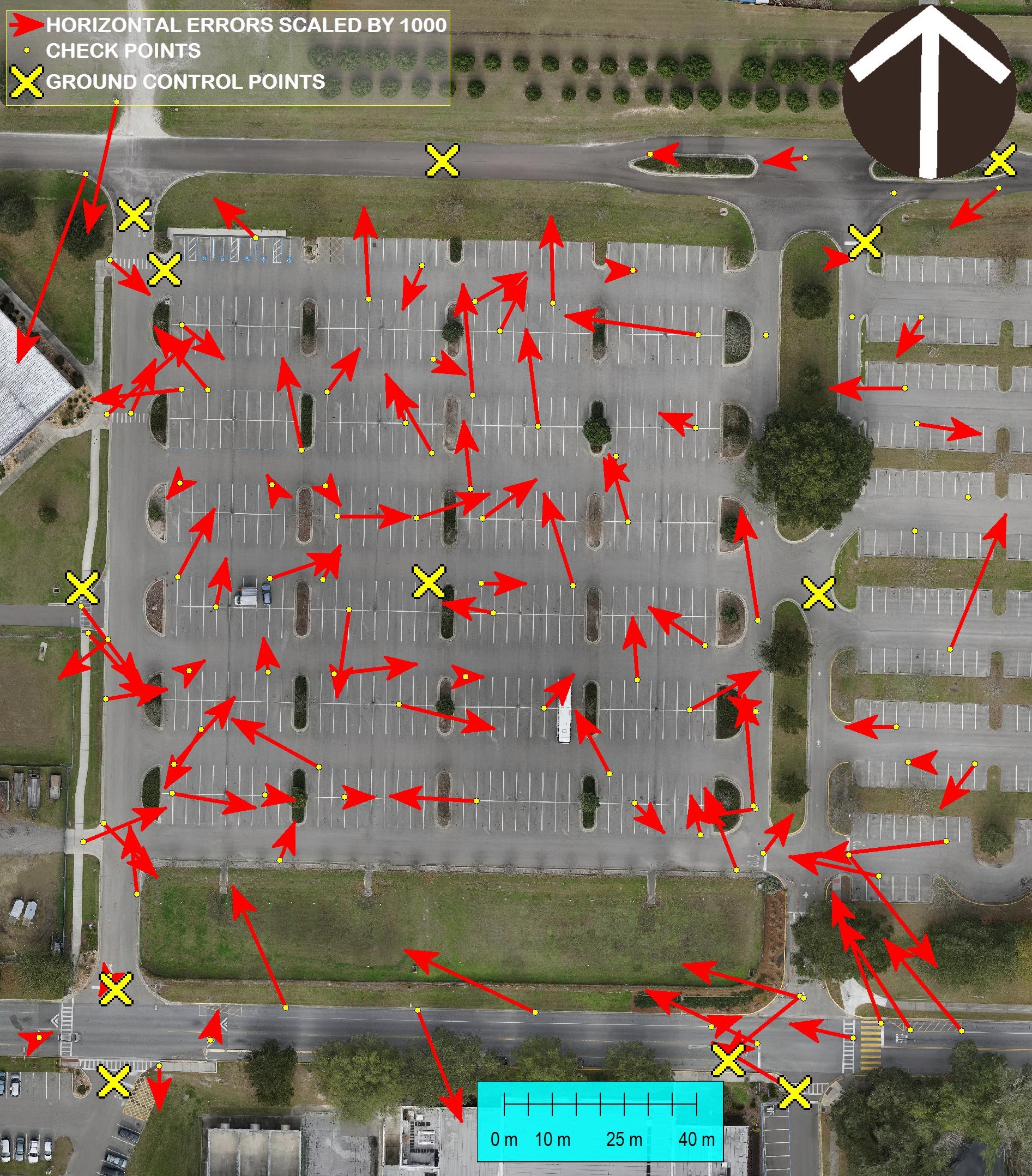
Accurate Surveying with Small Unmanned Aerial Systems and V-map The V-Map team is always concerned about accuracy of their work. In this photo we show a comparison between GPS and Ortho Photo coordinates of 105 check points. The ortho photo was produced from 261 24MP aerial images with a GSD (Ground Sampling Distance) of 13mm. […]
Continue reading