Accurate Surveying with Small Unmanned Aerial Systems and V-map
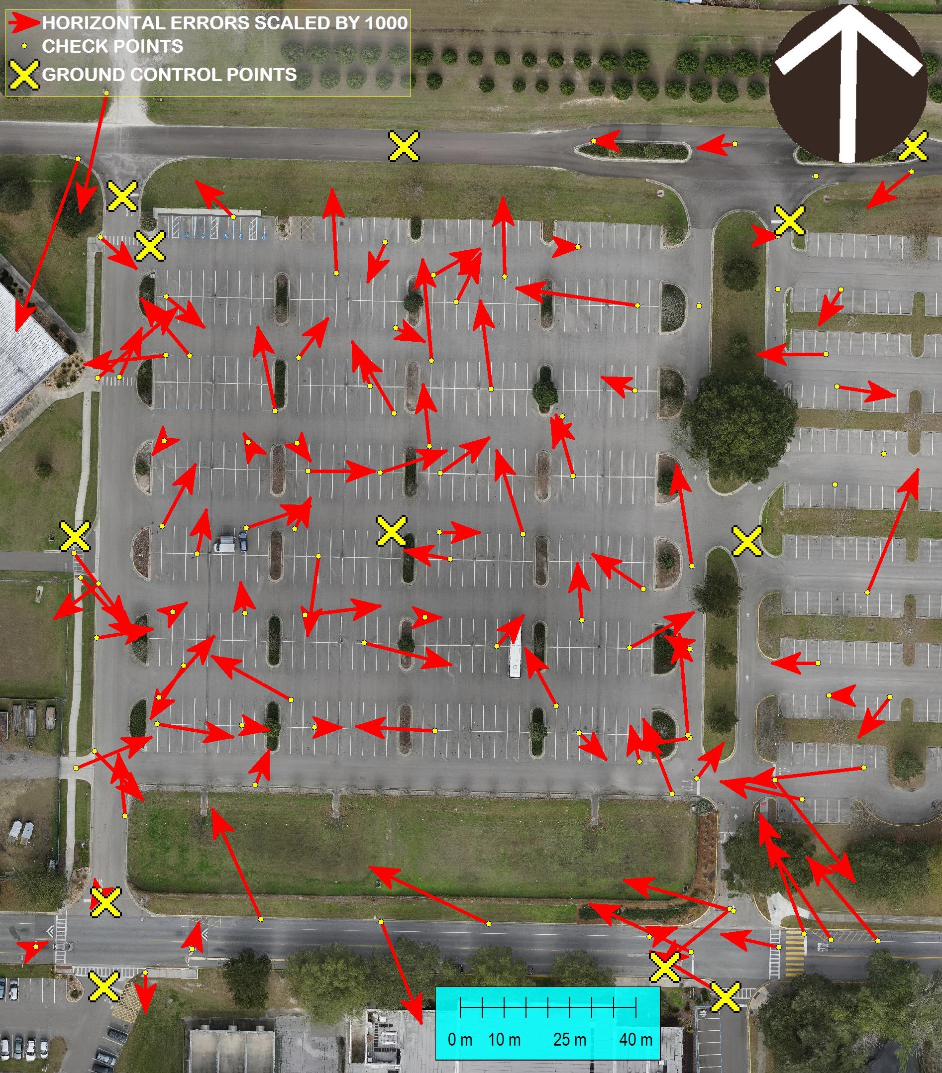
The V-Map team is always concerned about accuracy of their work. In this photo we show a comparison between GPS and Ortho Photo coordinates of 105 check points. The ortho photo was produced from 261 24MP aerial images with a GSD (Ground Sampling Distance) of 13mm. 12 Ground Control Points were used to accurately geo-reference the ortho photo. Note that for display purposes the arrows resembling the horizontal errors were scaled by a factor of 1000.
RESULTS:
Horizontal approximate circular error at 95% confidence: 0.028 Meters Vertical Accuracy at 95% confidence: 0.039 Meters Area mapped: 4.75ha Resolution: 13mm Crew field time: 20 minutes Ground Control with V-Map system, 15 minutes aerial image acquisition with modified Steadidrone