GNSS Basics for Beginners in Drone Mapping I think it is fair to assume that a significant number of drone owners have very little grasp of the importance of, and the role that Global Navigation Satellite Systems (GNSS) are playing in assisted flight and automated navigation. The reliability of orientation sensors, GNSS, powerful computers […]
Continue readingCategory Archives: V-Map
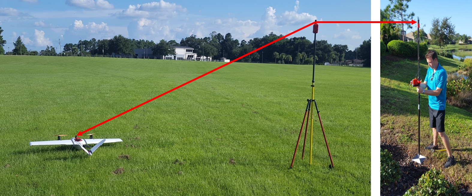
Drones, Dual Frequency GNSS, SfM and Property Surveys
In April of 2017, Walter Volkmann (President – Micro Aerial Projects L.L.C.) gave a presentation at Harvard University for the Harvard Humanitarian Initiative and Center for Geographic Analysis on the use of Dual Frequency GNSS and the Structure from Motion (SfM) technique. As a seasoned land-surveyor, Walter has worked around the globe on various mapping projects for private […]
Continue reading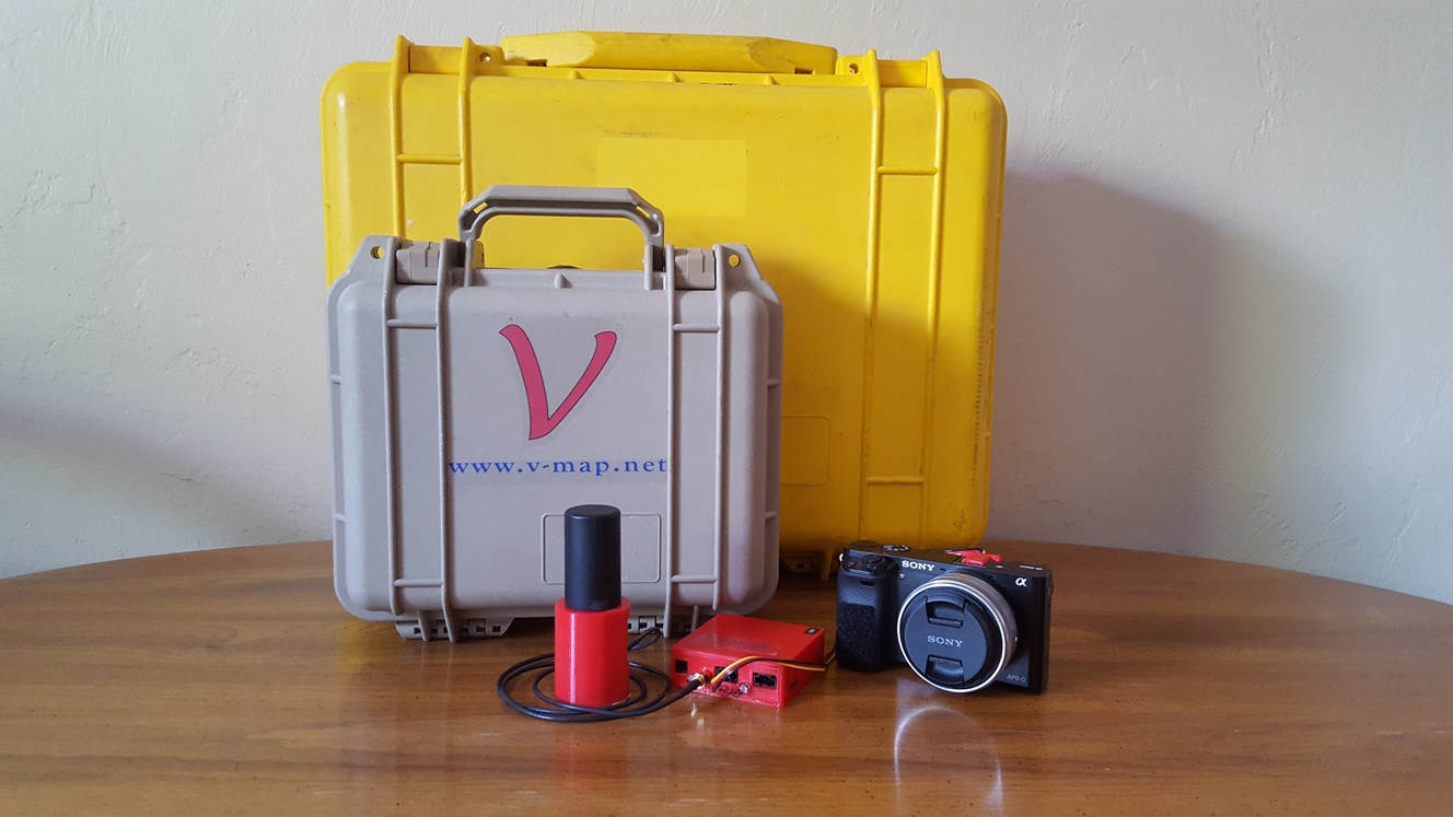
National Mapping and Resource Information Authority (NAMRIA) of the Republic of the Philippines certifies and registers V-Map receivers as suitable for “first order geodetic control positioning”
The National Mapping and Resource Information Authority (NAMRIA) of the Republic of the Philippines has certified and registered V-Map receivers as suitable for “first order geodetic control positioning”. It is not with surprise, but with considerable pride that we share with you the news that the National Mapping and Resource Information Authority (NAMRIA) of the […]
Continue reading
V-MAP AERIAL MAPPING SYSTEM ON THE TUFFWING UAV MAPPER
V-Map Aerial Mapping System on the TuffWing UAV Mapper In our continuing effort to improve on efficiency in Structure from Motion (SfM) mapping with small drones, we joined with Brian Christal of TuffWing to test the combination of the robust, no-nonsense UAV-Mapper with our dual frequency PPK GNSS V-Map System for a mapping technique […]
Continue reading
Drone Mapping Capacity Development – The Philippines
Walter Volkmann (CEO / Micro Aerial Projects L.L.C.) is currently in the Philippines providing Drone Mapping Capacity Development! Beneficiaries of this training include the Foundation for Economic Freedom (FEF), the Department of Environment and Natural Resources (DENR) and various other organizations and individuals. Using drones for mapping increases the efficiency and speed at which actionable data […]
Continue reading
Small Drone Cadastral Surveys
Small Drone Cadastral Surveys for Establishment of Property Rights (See mini-documentary below): In April 2016 Micro Aerial Projects L.L.C. participated in the “Technology for Property Rights” project managed by Foundation for Economic Freedom and The Asia Foundation with support from the Omidyar Network. This project aims to introduce sustainable technology which can accelerate the generation of land titles. Currently […]
Continue reading
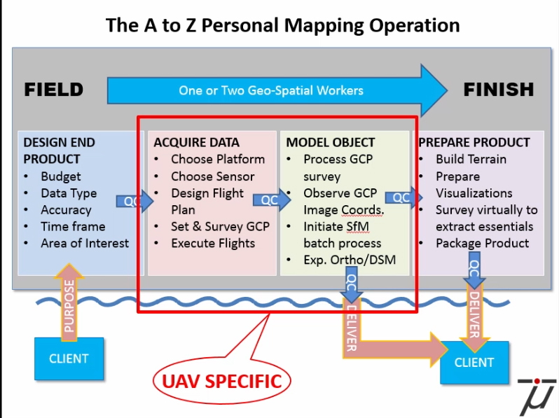
Making maps with Small Drones – 5 Steps
Until very recently the acquisition of aerial imagery was very expensive as it could only be done by manned aircraft or satellites equipped with special cameras or sensors. The high safety risks, operational complexity and acquisition and operational costs of these mapping techniques made them completely uneconomic for small projects such as mapping a single village or […]
Continue readingReporting Horizontal Errors in SfM Mapping
Fully appreciating the powerful role played by the Structure from Motion (SfM) technique in the mapping revolution, we understand that embedded in the fiber of an SfM produced map are some very important quality characteristics which, when not specifically disclosed and effectively displayed, will remain hidden to the user of the map. These characteristics can […]
Continue reading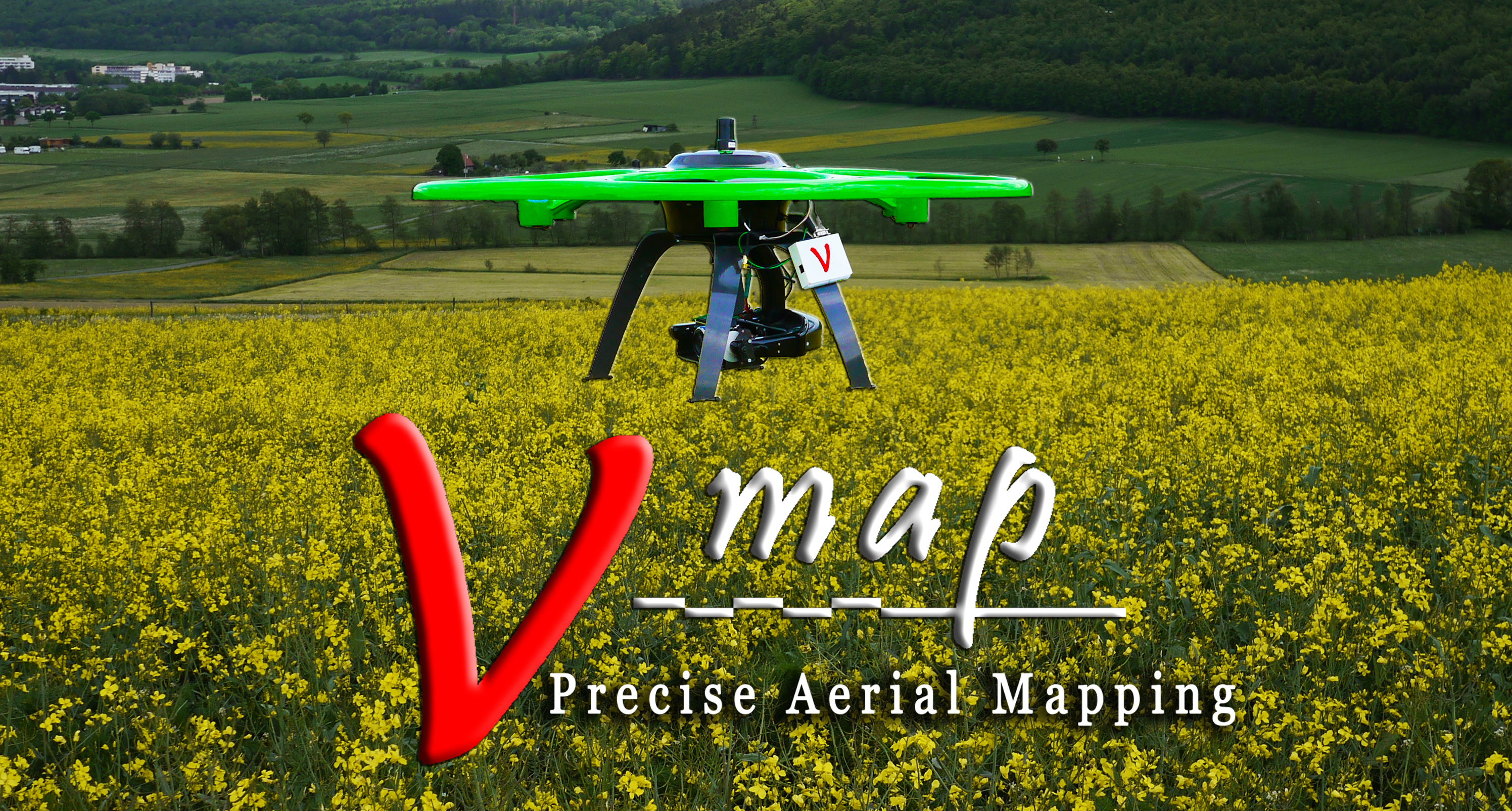
DUAL FREQUENCY GNSS ON MULTICOPTERS – SETTING THE RECORD STRAIGHT
THE HISTORY OF DUAL FREQUENCY GNSS ON MULTICOPTERS – SETTING THE RECORD STRAIGHT V-Map mounted on a modified Steadidrone The light weight dual frequency on board GNSS system for sUAVs was first conceptualized in September 2011 when we were once again frustrated by proprietary VTOL UAS manufacturers whom we could not convince of the advantages […]
Continue reading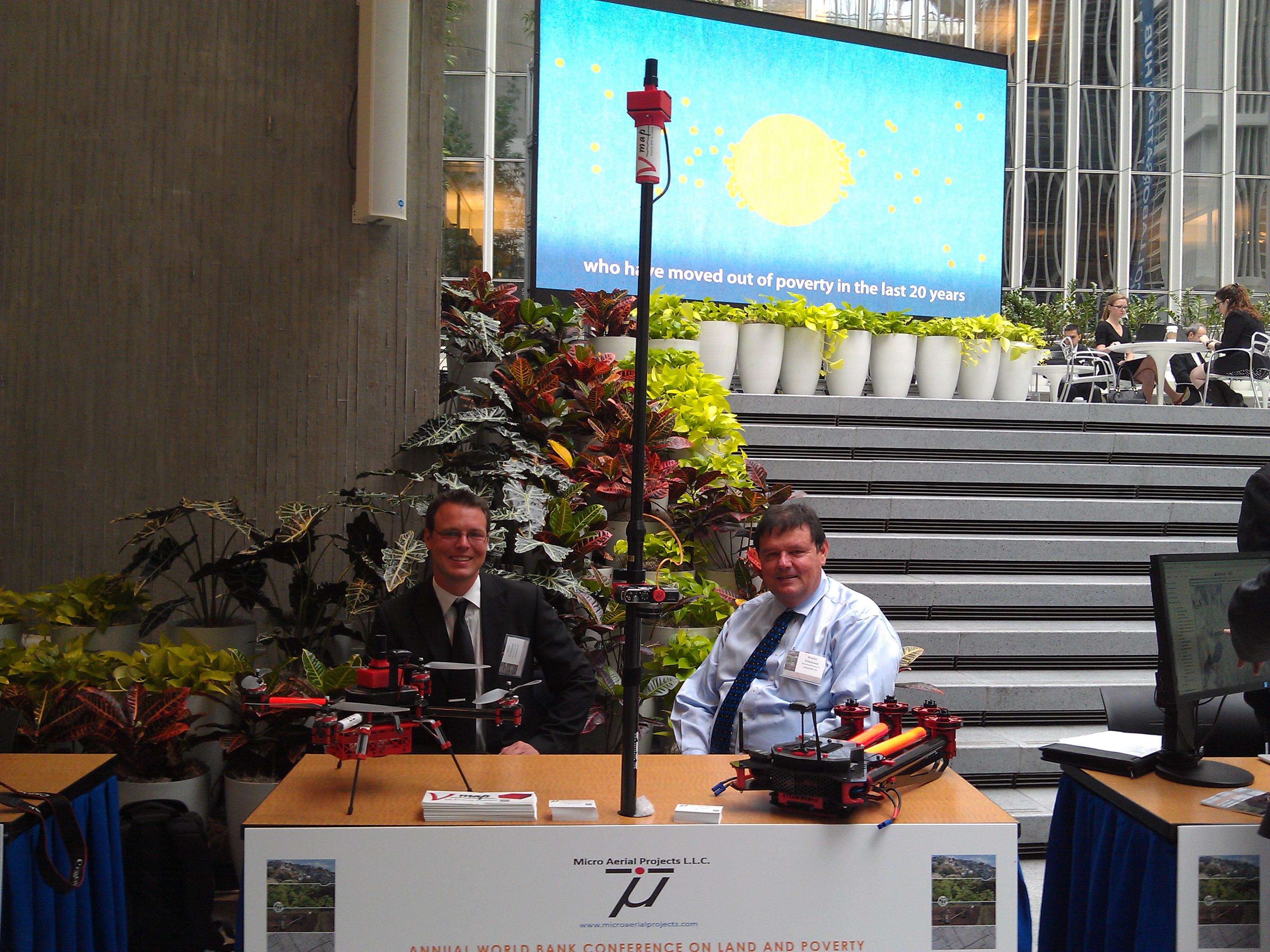
Micro Aerial Projects third World Bank Conference
Micro Aerial Projects third World Bank Conference Three years ago (2013), Micro Aerial Projects L.L.C. first attended the World Bank Conference on Land and Poverty giving a paper with Dr. Grenville Barnes of the University of Florida and Kevin Barthel of the Land Alliance titled “Using Unmanned Aerial Vehicles (UAVs) to democratize spatial data production: […]
Continue reading