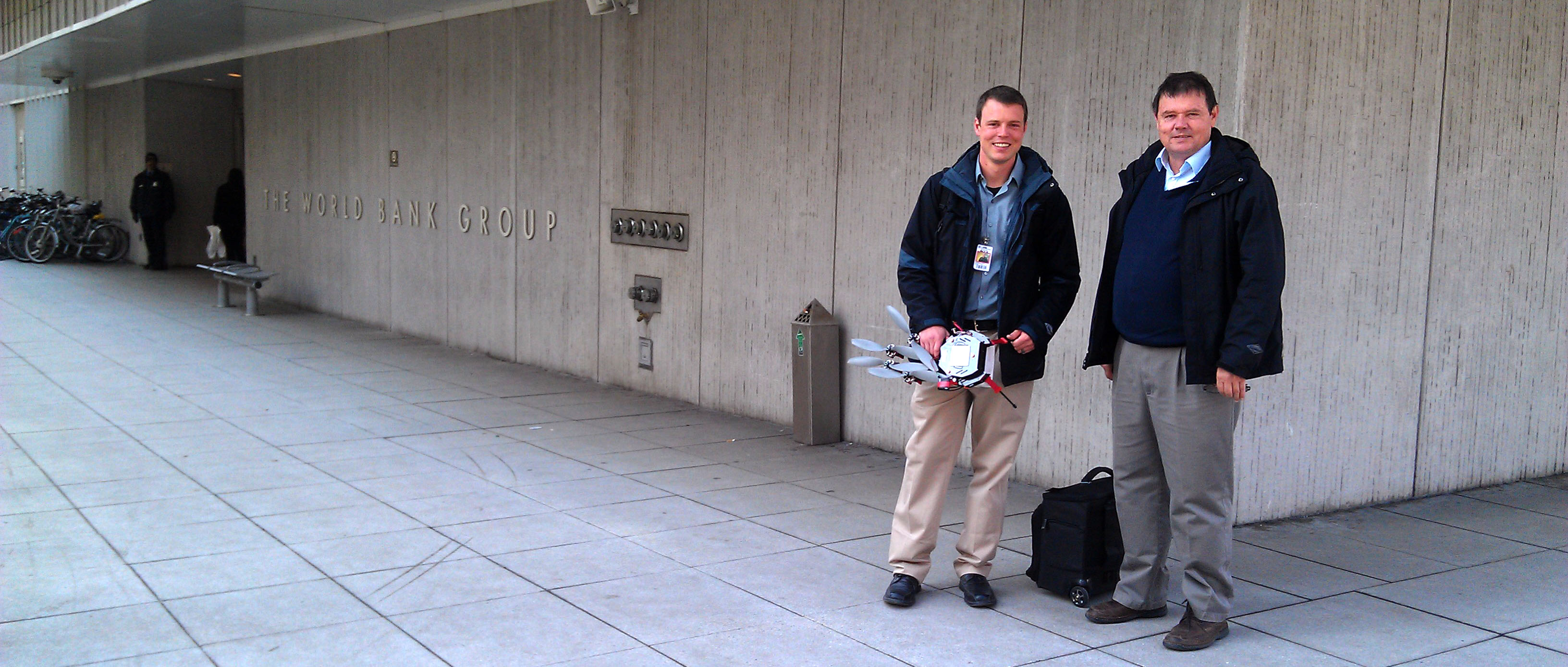
MICRO AERIAL PROJECTS LLC AT WORLD BANK CONFERENCE INNOVATION FAIR We are pleased to be exhibiting at the Innovation Fair of the annual World Bank Conference on Land and Poverty on Thursday, March 26 in Washington DC. Our highly automated and affordable, products and services provide an opportunity to build local small enterprise capacities in aerial […]
Continue readingAuthor Archives: admin
MAKING ACCURATE MAPS WITH SMALL DRONES – REAL VALUE FOR MONEY
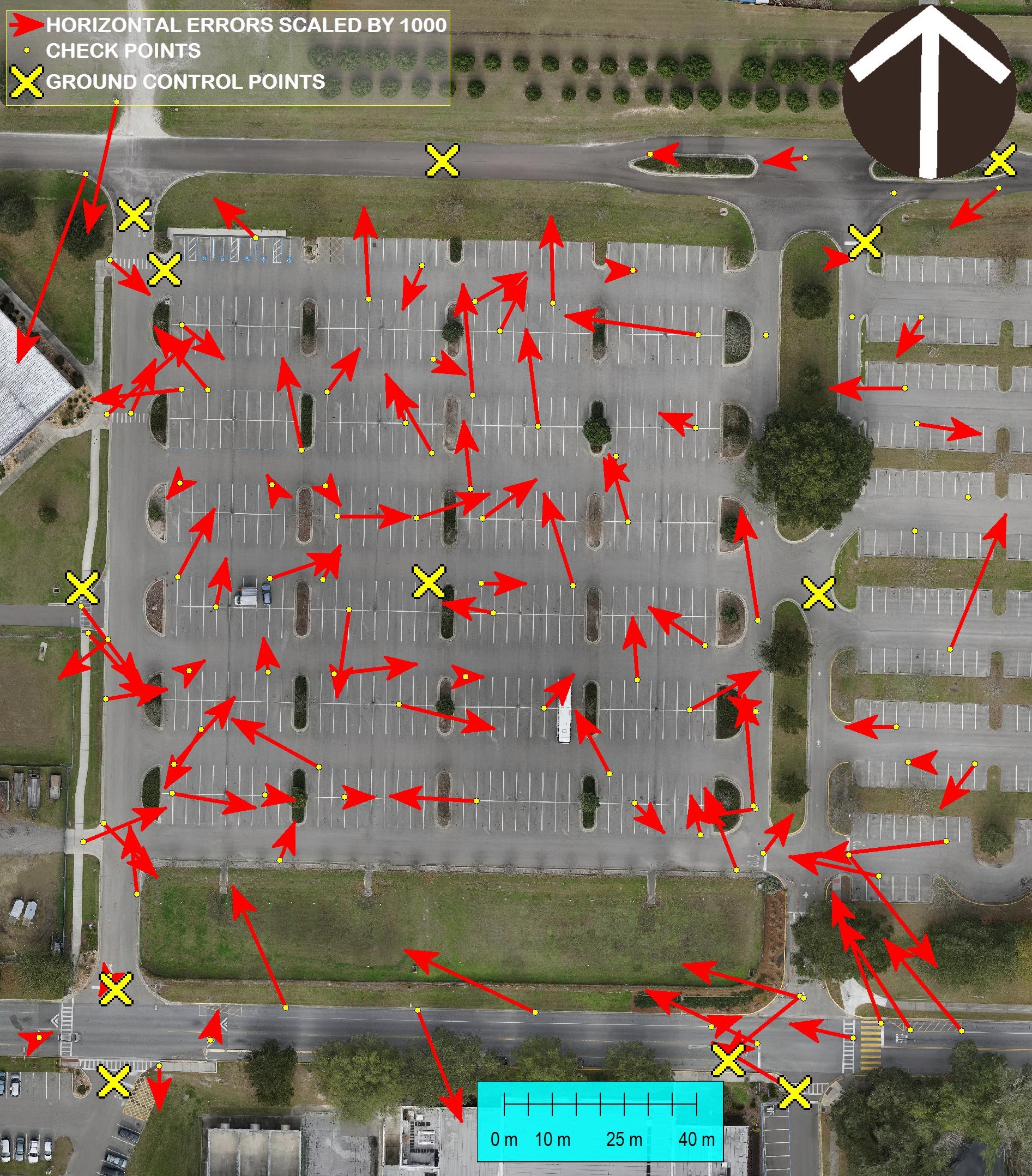
Accurate Surveying with Small Unmanned Aerial Systems and V-map The V-Map team is always concerned about accuracy of their work. In this photo we show a comparison between GPS and Ortho Photo coordinates of 105 check points. The ortho photo was produced from 261 24MP aerial images with a GSD (Ground Sampling Distance) of 13mm. […]
Continue reading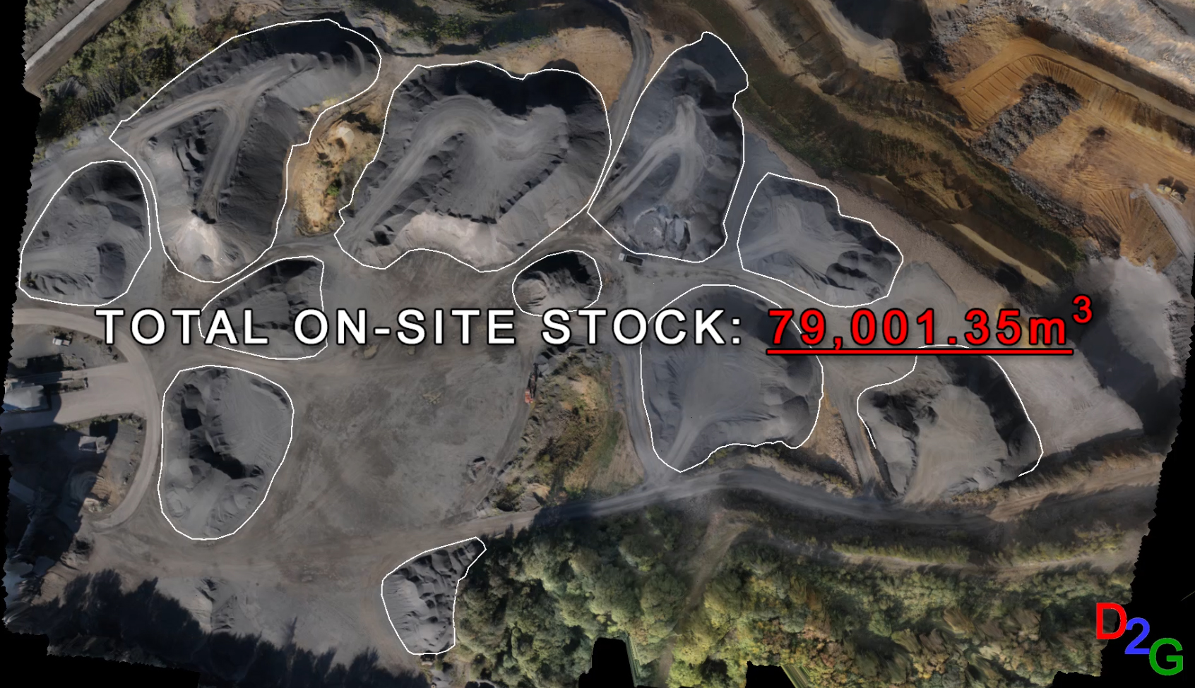
Surveying with drone2GIS Inc.
Drone2GIS offers a safe, efficient and accurate alternative approach to the conventional surveying method employed in open cast mines, quarries and stock yards for data acquisition. Through the employment of Unmanned Aerial Systems, Drone2GIS delivers precise, high accuracy ortho-photos, digital terrain models and virtual realities. With these products, we can extract features and positions to […]
Continue reading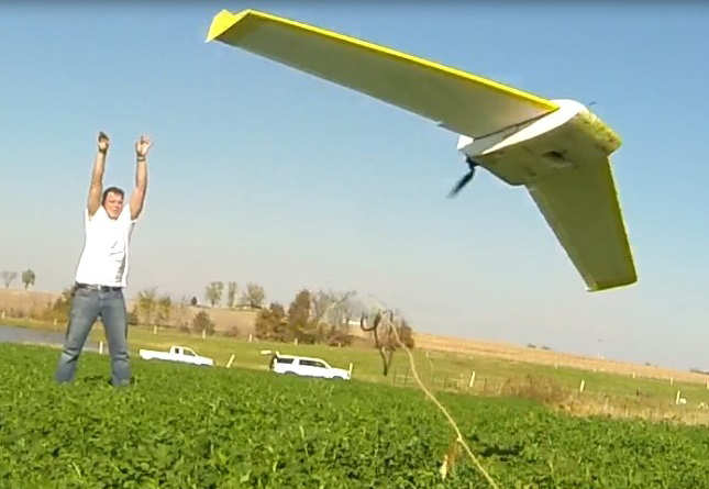
The new map
Micro Aerial Projects had the pleasure of working on this project with drone2GIS. Take a look at this video in which you will see how we are changing the geospatial product landscape! Sit back, relax and experience the new mapping standard as we take you through an example of drone2GIS Inc‘s work in an agricultural […]
Continue reading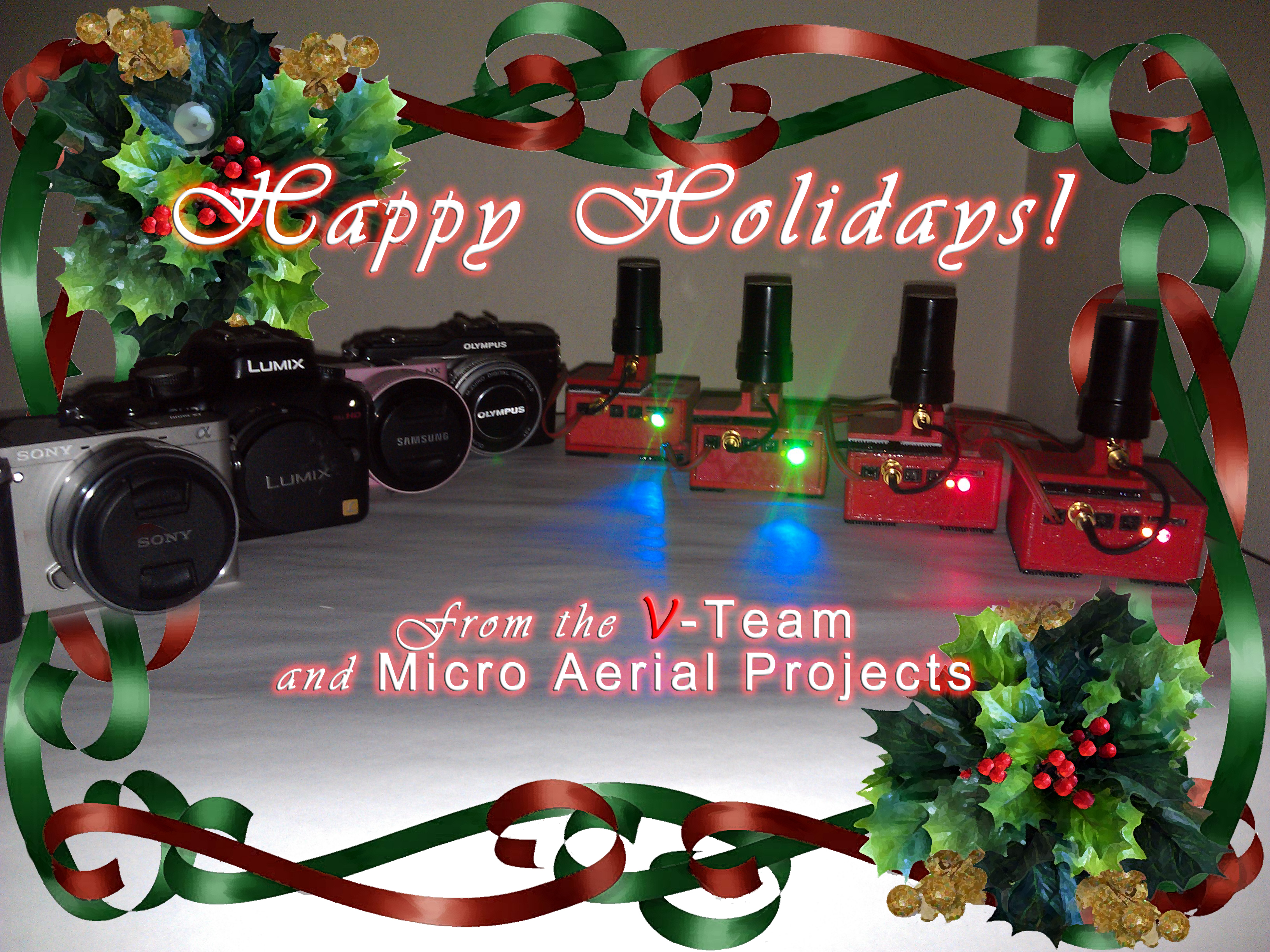
Happy Holidays from Micro Aerial Projects!
It has been an exciting year and we would like to thank each and everyone of you for your support, business and interest in what “V” do! Wishing you happy holidays and all the best for 2015!
Continue reading
UAS MAPPING 2014 RENO
UAS MAPPING 2014 Reno NV ASPRS UAS Technical Demonstration and Symposium Micro Aerial Projects L.L.C. invites you to attend the UAS MAPPING 2014 Reno NV ASPRS UAS Technical Demonstration and Symposium on October 21-22 in Reno Nevada (USA)! Come see us in Booth #210 to find out how you can professionalize your personal mapping drone with the V-map […]
Continue reading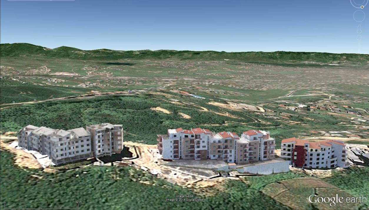
Mapping Urban Areas with UAVs
In case you missed our presentation on Mapping Urban Areas with UAVs at the annual meeting of the Florida Region ASPRS (American Society for Photogrammetry and Remote Sensing) last Friday, August 15th 2014, here is your opportunity to see it! The presentation covers some of our work in Albania where we used a SteadiDrone QU4D […]
Continue reading