GNSS Basics for Beginners in Drone Mapping I think it is fair to assume that a significant number of drone owners have very little grasp of the importance of, and the role that Global Navigation Satellite Systems (GNSS) are playing in assisted flight and automated navigation. The reliability of orientation sensors, GNSS, powerful computers […]
Continue readingAuthor Archives: M V
National Mapping and Resource Information Authority (NAMRIA) of the Republic of the Philippines certifies and registers V-Map receivers as suitable for “first order geodetic control positioning”
The National Mapping and Resource Information Authority (NAMRIA) of the Republic of the Philippines has certified and registered V-Map receivers as suitable for “first order geodetic control positioning”. It is not with surprise, but with considerable pride that we share with you the news that the National Mapping and Resource Information Authority (NAMRIA) of the […]
Continue reading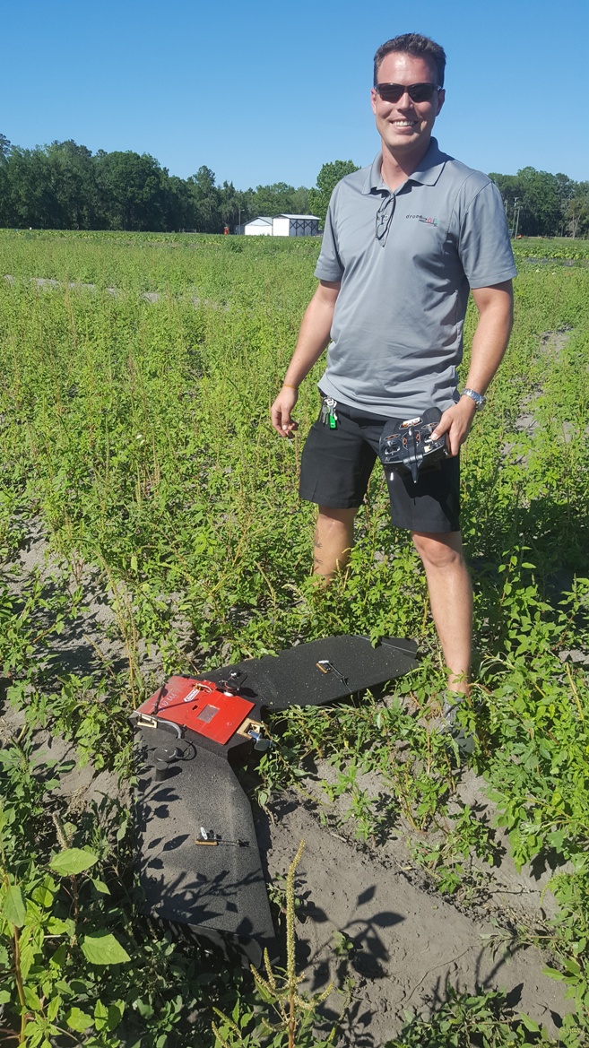
V-MAP AERIAL MAPPING SYSTEM ON THE TUFFWING UAV MAPPER
V-Map Aerial Mapping System on the TuffWing UAV Mapper In our continuing effort to improve on efficiency in Structure from Motion (SfM) mapping with small drones, we joined with Brian Christal of TuffWing to test the combination of the robust, no-nonsense UAV-Mapper with our dual frequency PPK GNSS V-Map System for a mapping technique […]
Continue reading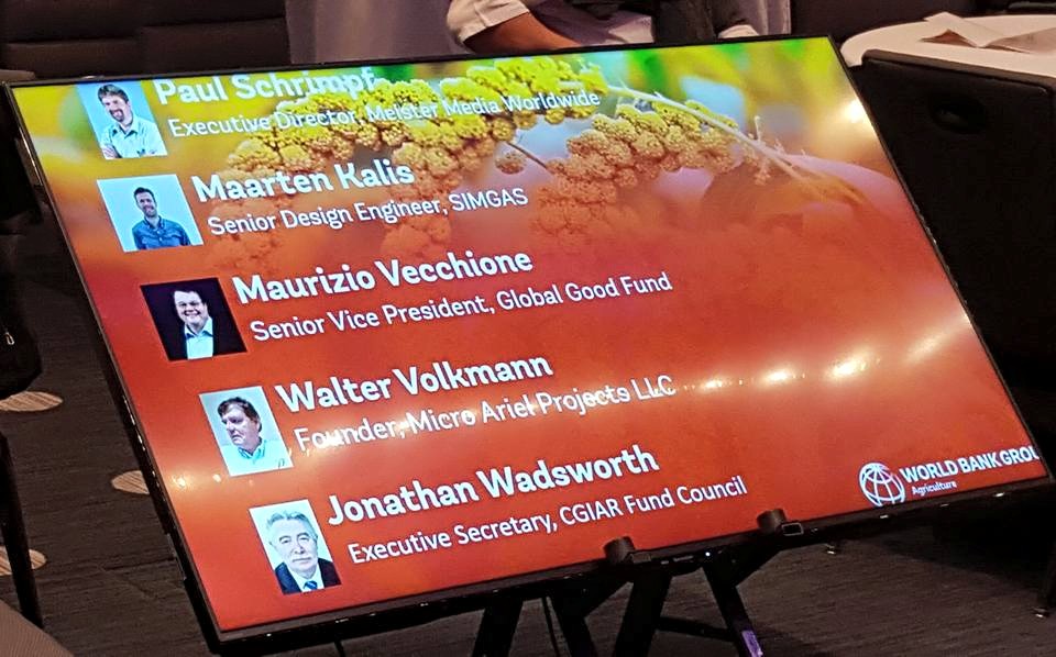
Talking about small drones at the World Bank Forum on Agriculture, 2016
On February 18 at the 2016 World Bank Forum on Agriculture in Washington, D.C. I had the pleasure of sharing the podium with some important people in international development. I talked about small drones and their potential in helping farmers to monitor and manage their crops and animals. And I learned a lot from my […]
Continue reading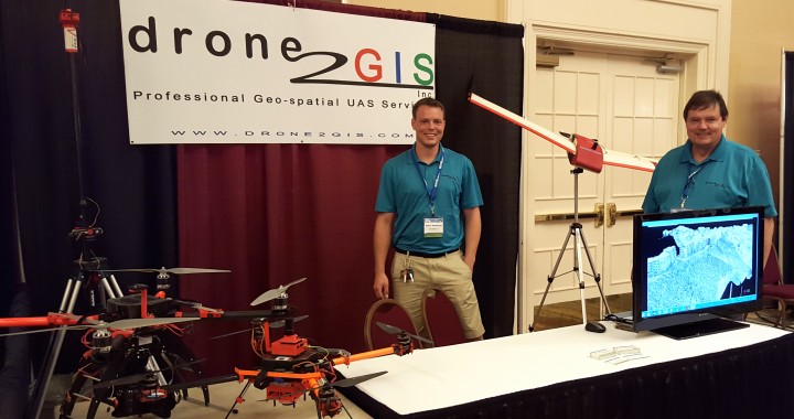
The Mapping Revolution
Our sister company, Drone2GIS, just returned from the 60th Annual General Meeting of the Florida Surveying and Mapping Society (FSMS) in Naples Florida where we showcased the revolutionary mapping capabilities of small unmanned aerial systems (drones) and Structure from Motion (SfM) processing software. Have a look at our video which highlights this mapping revolution: Take […]
Continue reading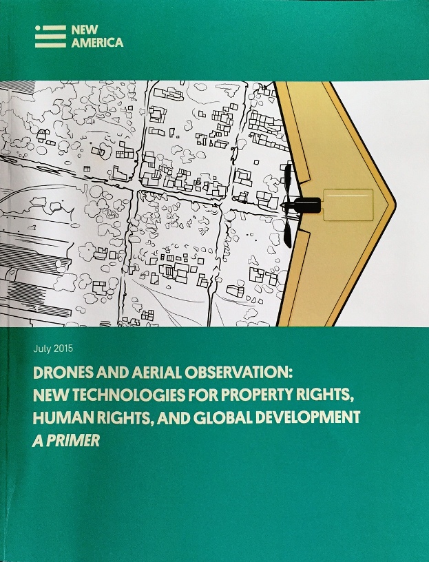
PERSONAL MAPPING DRONES IN LAND ADMINISTRATION, AGRICULTURE AND CONSERVATION
I just returned from a conference in Washington D.C. at which New America launched a well written primer for geospatial practitioners, land administrators and stake holders: Drones and Aerial Observation: New Technologies for Property Rights, Human Rights, and Global Development: We are pleased to see that our work has enabled us to […]
Continue reading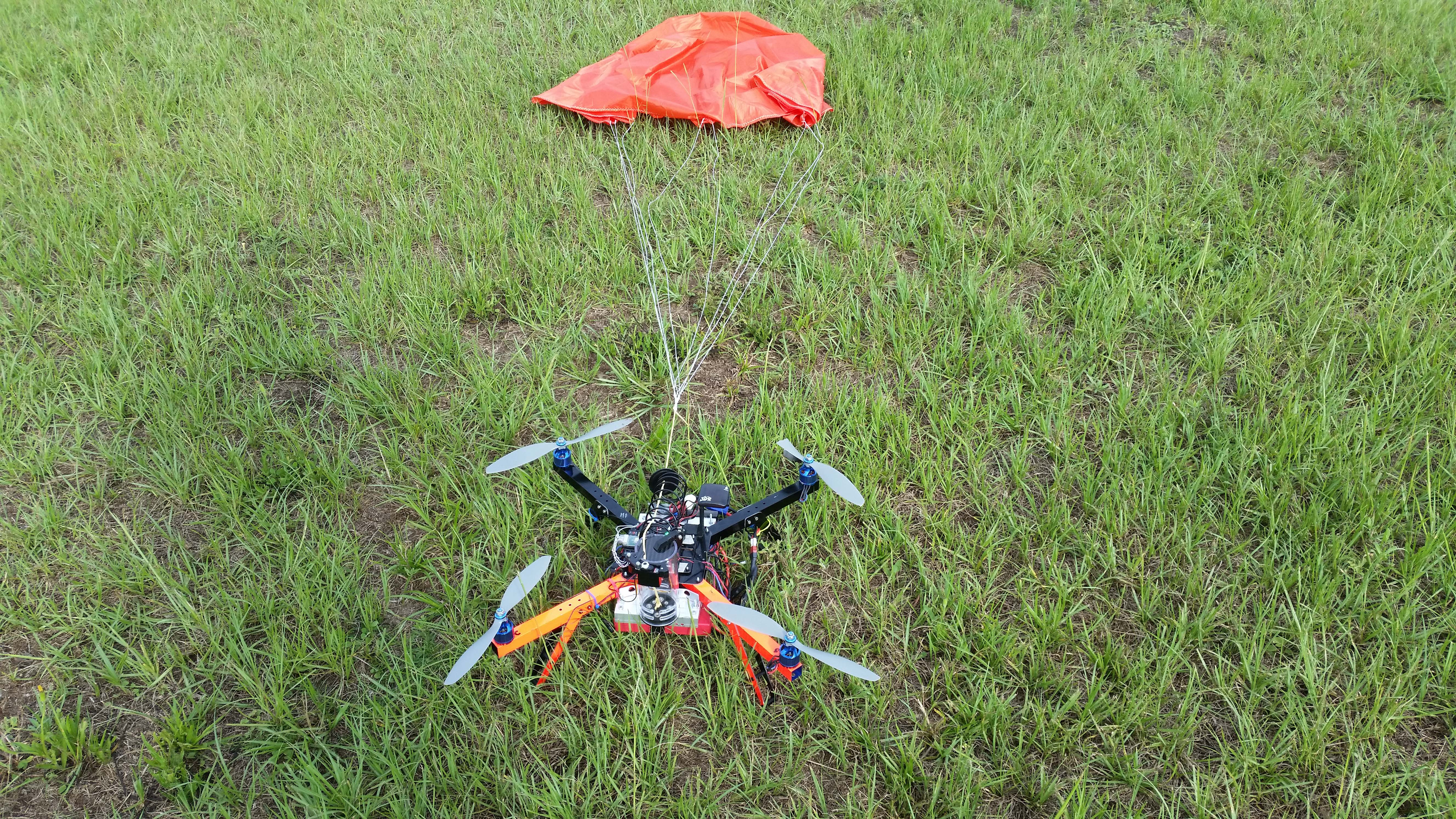
Safety first: using parachutes on our drones
The Micro Aerial Projects V-Team philosophy in action: safety first! Using parachutes on our drones….
Continue reading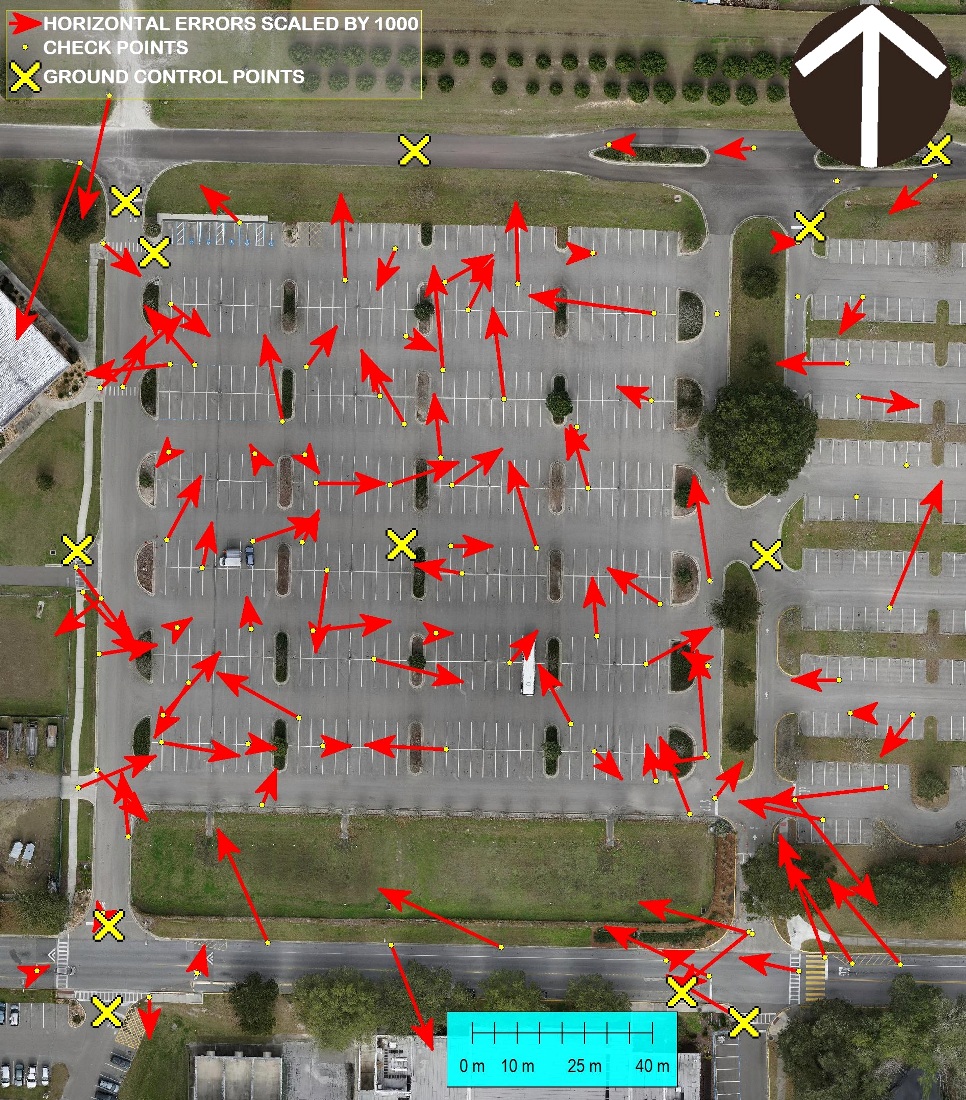
MICRO AERIAL PROJECTS OFFERING MASTER CLASS AT ANNUAL WORLD BANK CONFERENCE IN WASHINGTON, D.C. MARCH 27
We are busy with final preparations for our participation at the Innovation Fair of this year’s annual Land and Poverty Conference organized by the World Bank in Washington DC where we will also be hosting a Master Class. High Resolution Mapping With Small Unmanned Aerial Vehicles (UAVS) March 27, 2015, 09h00-10h30 1818 H Street NW […]
Continue reading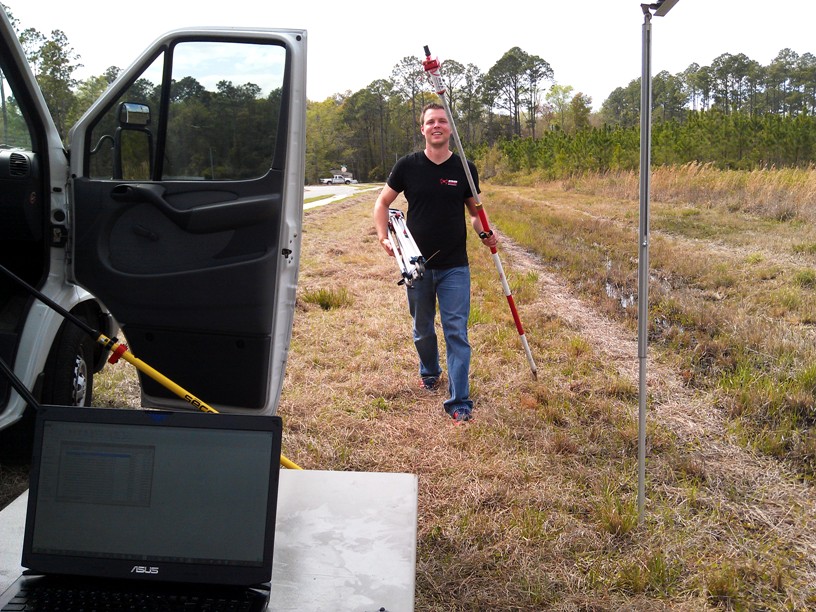
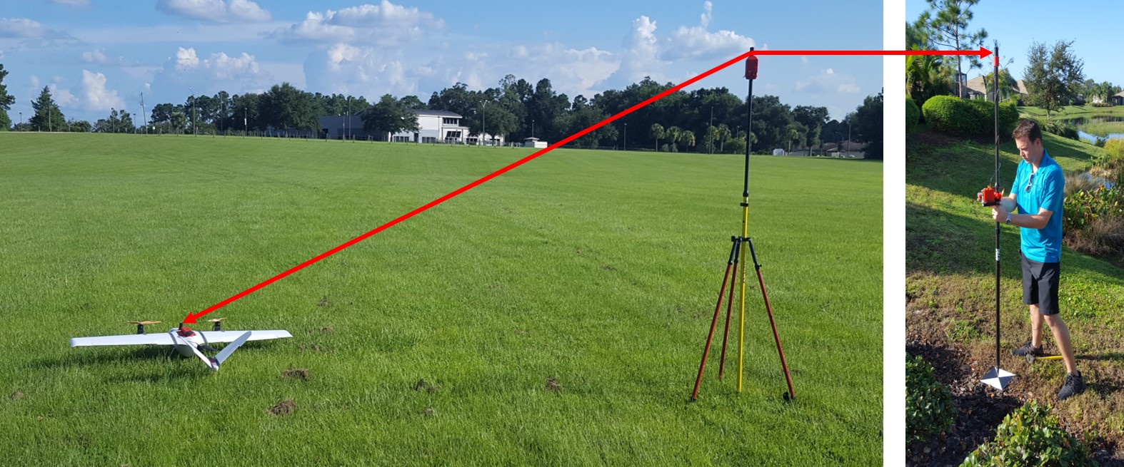
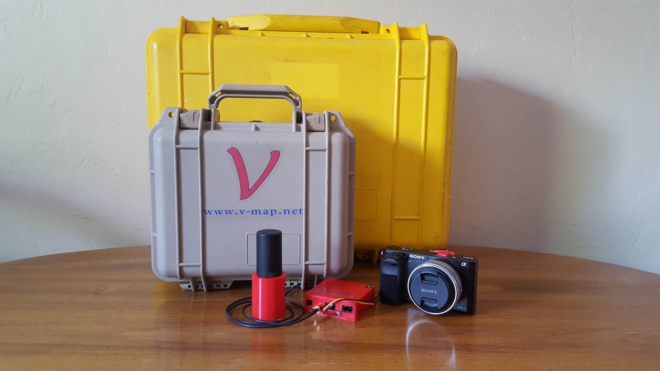
The V-Map System in Action
It takes more than drones to make high quality maps. Using our dual frequency ultra-fast (20Hz) ultra-light (130g) V-Map system we can very quickly determine precise coordinates for Ground Control Points as well as Camera Exposure Positions. The V-Map system provides the back-bone to high quality drone mapping. The V-Map System used as […]
Continue reading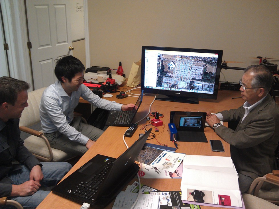
Sharing the V-Map Experience with Friends from Japan
Sharing the V-Map Experience Sharing the V-Map experience with Mr. Masuda Tishinobu, President of Kaiteki-Kukan FC CO., Ltd The V-Map system is generating interest around the world. On Wednesday we enjoyed a visit from Japanese friends. In Japan, which is one of the most densely populated countries in the world there are hardly any regulatory […]
Continue reading