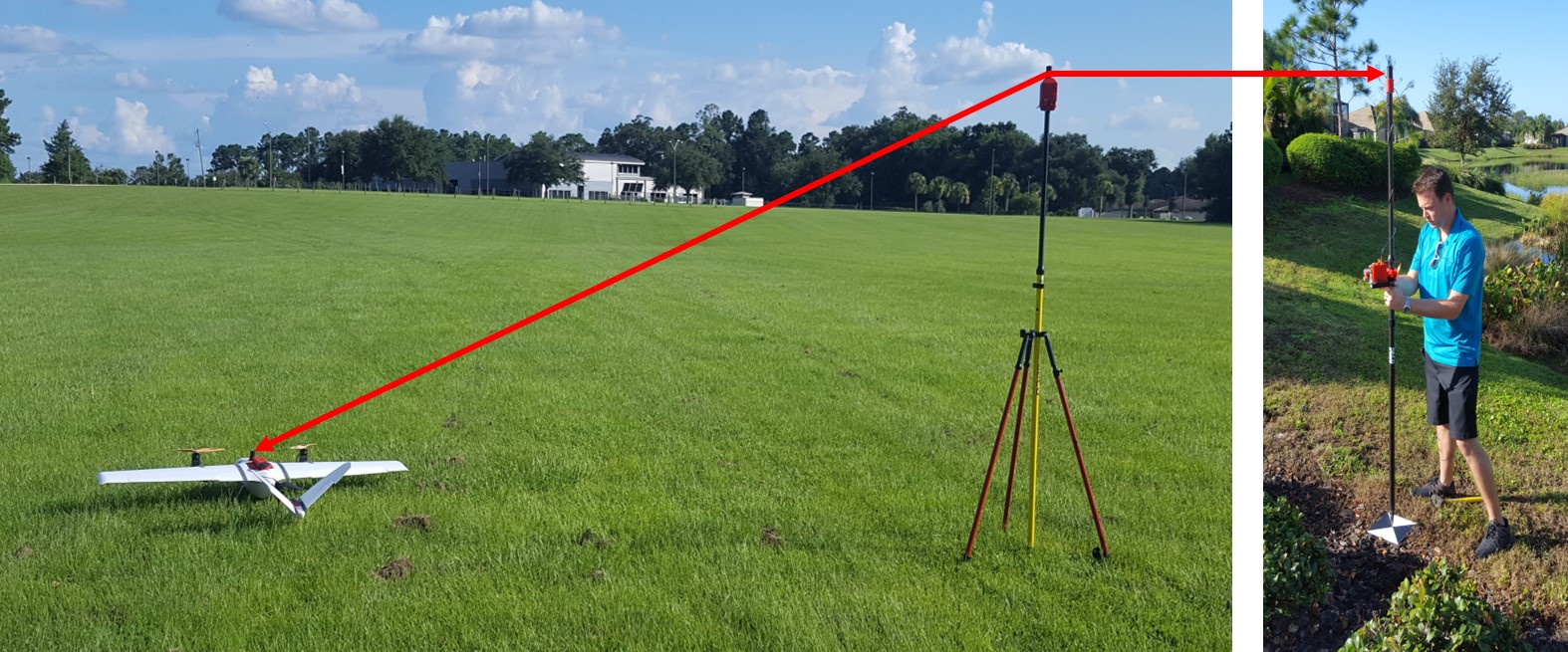
GNSS Basics for Beginners in Drone Mapping I think it is fair to assume that a significant number of drone owners have very little grasp of the importance of, and the role that Global Navigation Satellite Systems (GNSS) are playing in assisted flight and automated navigation. The reliability of orientation sensors, GNSS, powerful computers […]
Continue readingCategory Archives: Industrial Inspections

Micro Aerial Projects third World Bank Conference
Micro Aerial Projects third World Bank Conference Three years ago (2013), Micro Aerial Projects L.L.C. first attended the World Bank Conference on Land and Poverty giving a paper with Dr. Grenville Barnes of the University of Florida and Kevin Barthel of the Land Alliance titled “Using Unmanned Aerial Vehicles (UAVs) to democratize spatial data production: […]
Continue reading
SNEAK PREVIEW OF A NEW SPECIES RECENTLY SIGHTED IN THE AMERICAN SKIES
A new species recently sighted in the American skies… Name: Bateleur (belongs to the Pixhawk family) Color: White with yellow wingtips, distinctive black spot on chest Habitat: Over fields, farms and towns anywhere on the North American Continent Flight Characteristics: Flies automatically in straight lines and graceful circles Call: Faint humming with occasional beeps Habits: […]
Continue reading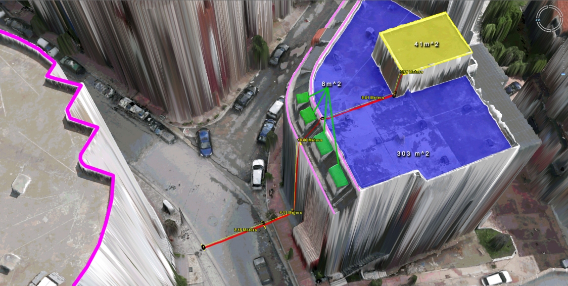
Virtual Surveyor Tools
What to do with those millions of triangles defining the geometry of an Urban Environment? Enter the Virtual Surveyor Tools. An all too often underestimated step in the workflow of a UAV mapping operation is the extraction of features of interest in vector format. Structure from Motion and Lidar give us unprecedented density in point […]
Continue reading