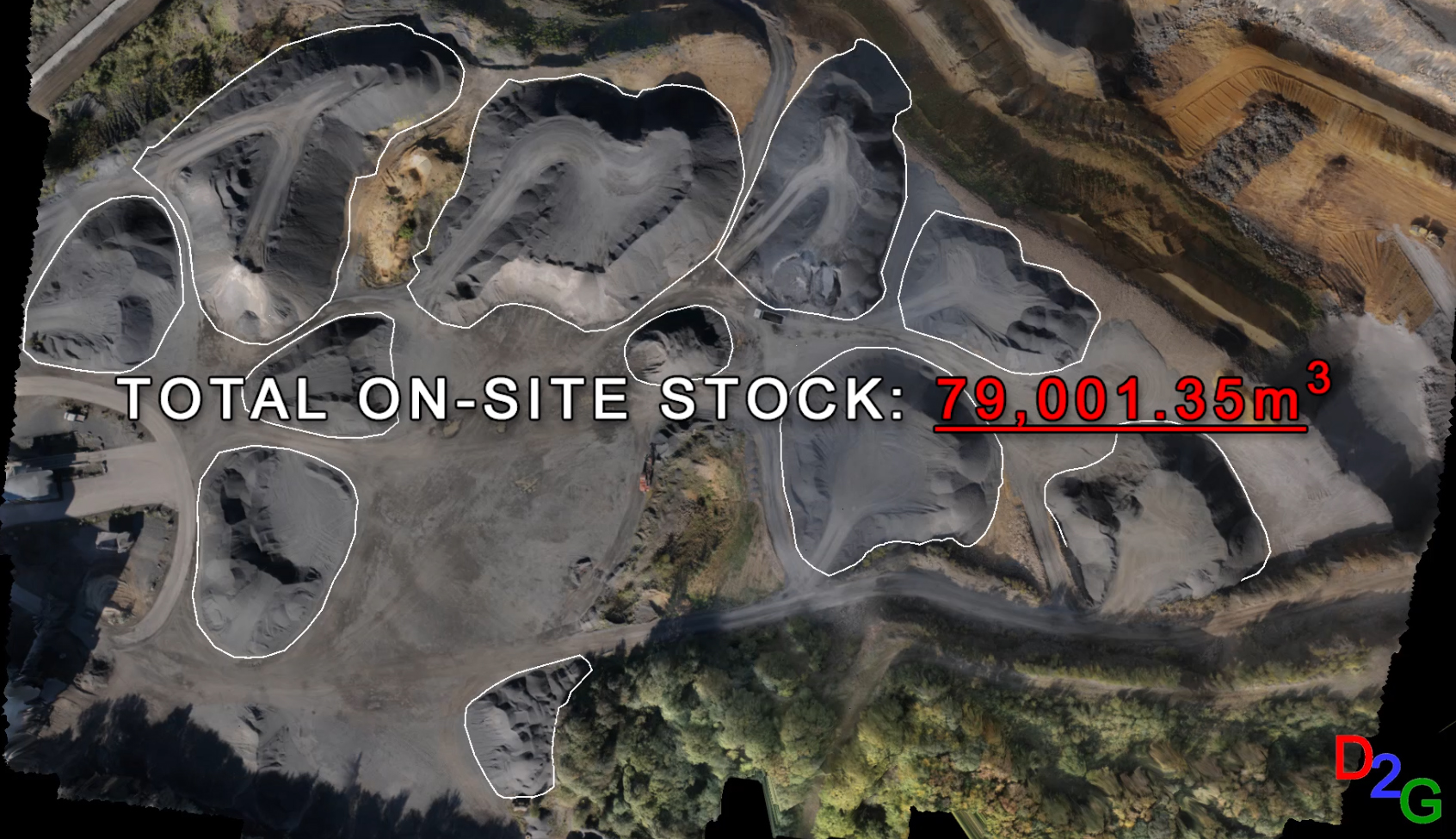
Drone2GIS offers a safe, efficient and accurate alternative approach to the conventional surveying method employed in open cast mines, quarries and stock yards for data acquisition. Through the employment of Unmanned Aerial Systems, Drone2GIS delivers precise, high accuracy ortho-photos, digital terrain models and virtual realities. With these products, we can extract features and positions to produce the same products one would expect from a conventional survey without the safety risks of having boots on the ground. Data can be captured as and when needed without significant impact on the day to day operation of the site and at a fraction of the time it would otherwise take. Take stock of your inventory with accurate volume measurements, visualize your site without the stock piles, and get the data you need when you need it with minimal impact on production!
Surveying in an opencast mine, quarry or a stock yard has challenges. Setting up terrestrial scanners and other survey devices in the traffic of heavy equipment either slows down production or poses serious safety risks to the survey crews. Other safety and health risks involve steep ledges, potential for rock/land slides, noise and dust. Conventional surveying takes time, involves more than one person and can be very expensive. In addition to the safety concerns, logistics can also become difficult as parts of the location may need to be shut down while the survey takes place.
Drone2GIS’s approach saves time and money while ensuring a safer operation without boots on the ground. Contact them at info@drone2GIS.com for more information on how they can help increase the safety, efficiency and profitability of your operation!